The most problematic area on the entire traverse route would undoubtedly be the Shear Zone. Just 30 miles from McMurdo the greater Ross Ice Shelf tries to bend its way around Ross Island. When this happens the glacial ice rips apart, forming massive crevasses. Crossing this area is dangerous. The crevasses must be detected, assessed, and sometimes destroyed if necessary.
 A Shear Zone passage can be intimidating, especially if you’ve seen pictures of how large the crevasses can be. A quick observation of the area reveals no indication that there could be a giant void underneath your feet. From the surface it looks completely flat and unthreatening. We must use Ground Penetrating Radar (GPR) to detect the crevasses.
All the crevasses are marked with 2X4 posts and some have names. There is Mongo, Strangebrew, Personal Space, Baby, Battery Crack, Baby 2, Juanita, Ten O’clock Break, Snap, Crackle, Pop… just to name a few. And in the middle of all this chaos, there’s the ‘Miracle Mile’ where for some reason there are no crevasses at all.
Today we blasted the two suspect crevasses. We believe the snow bridging them is too thin to support the weight of our tractors. So we blow them up and then fill the resulting hole with snow.

The explosions were impressive. The first crevasse was relatively small. The second however was quite large- over 100 feet deep and 20 feet wide in places.

This is a NEW crevasse and we got to name it. We gave it the name…wait for it… Justin Bieber. Yup. I’m not sure why we gave it that name, but Derrick keeps calling it Justin BEAVER and this annoys me.
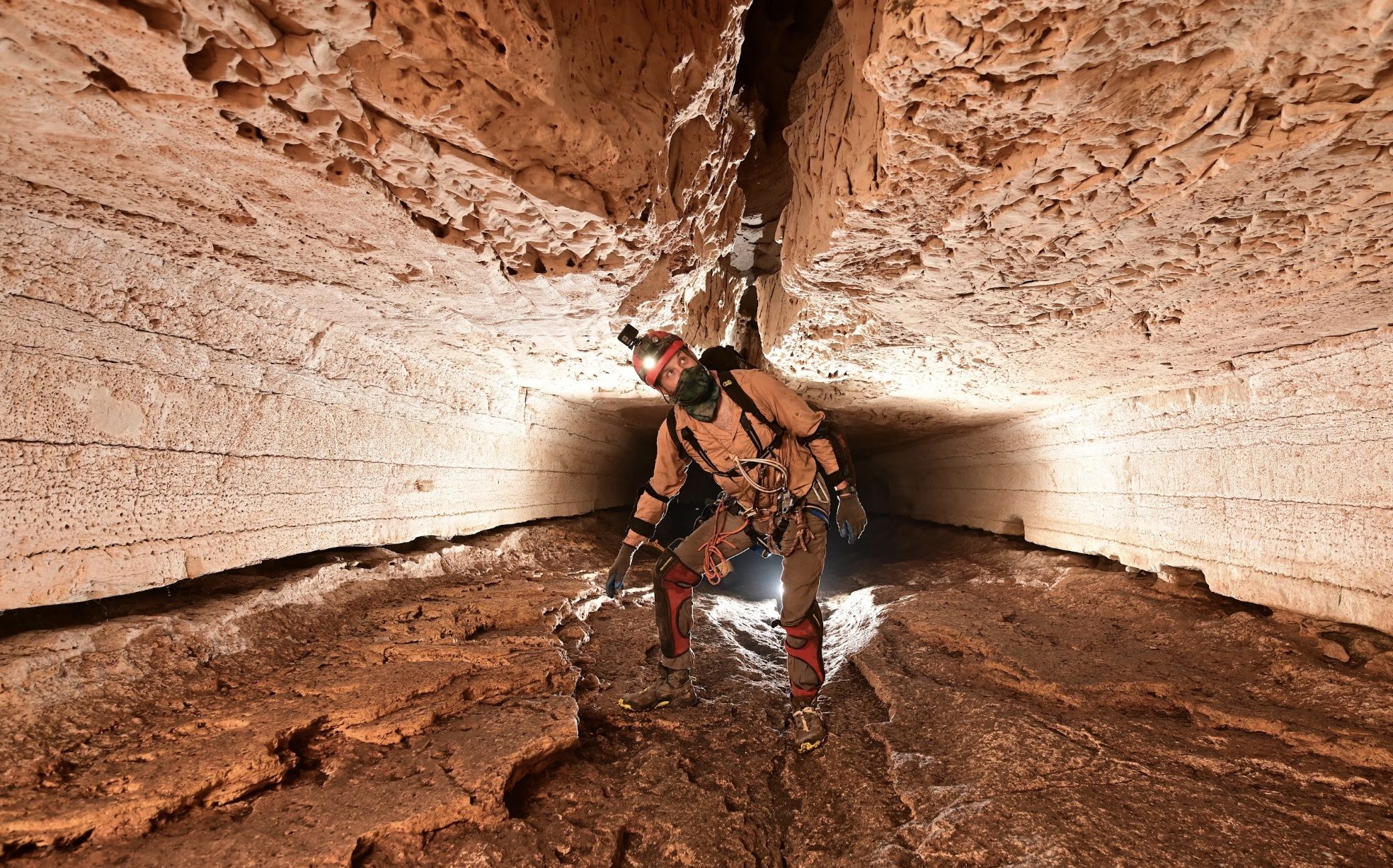
These giant canyons underneath the snow have never been viewed before. That’s a rare thing this day and age to see something that no one has ever seen. We took the time to repel into the largest one to check it out.


Above: View from inside the crevasse looking up.
Below: A crevasse as seen with Ground Penetrating Radar