Guyana Packrafting

boats.JPG

“Will the piranha bite my boat?” I asked our Makushi guide who’d led the 7-hour trek through the jungle of southern Guyana. The man eyed the inflatable packraft perched on the muddy bank of the Kwitaro River.

“Maybe,” he said. “Don’t dangle things in water.”

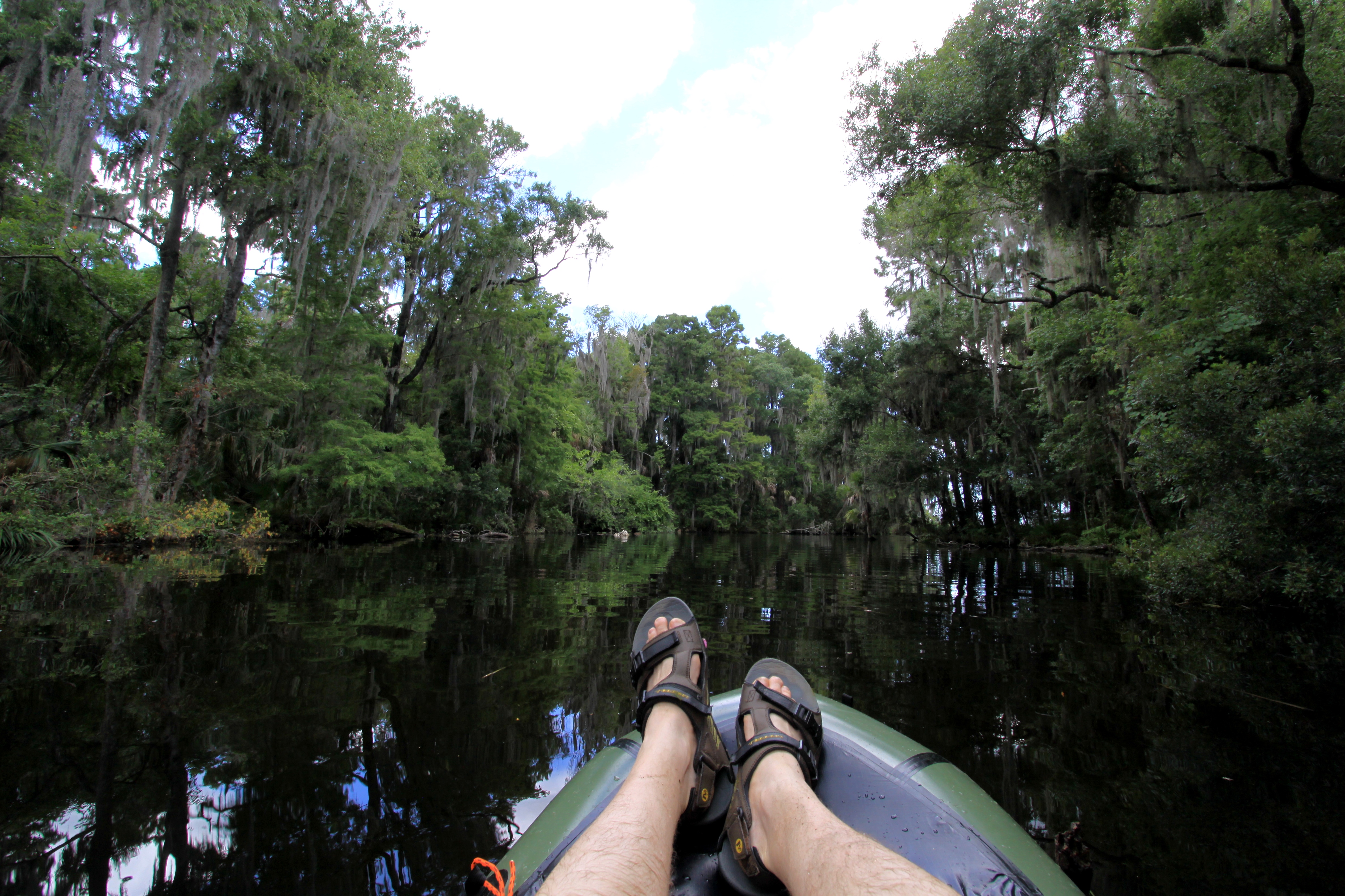
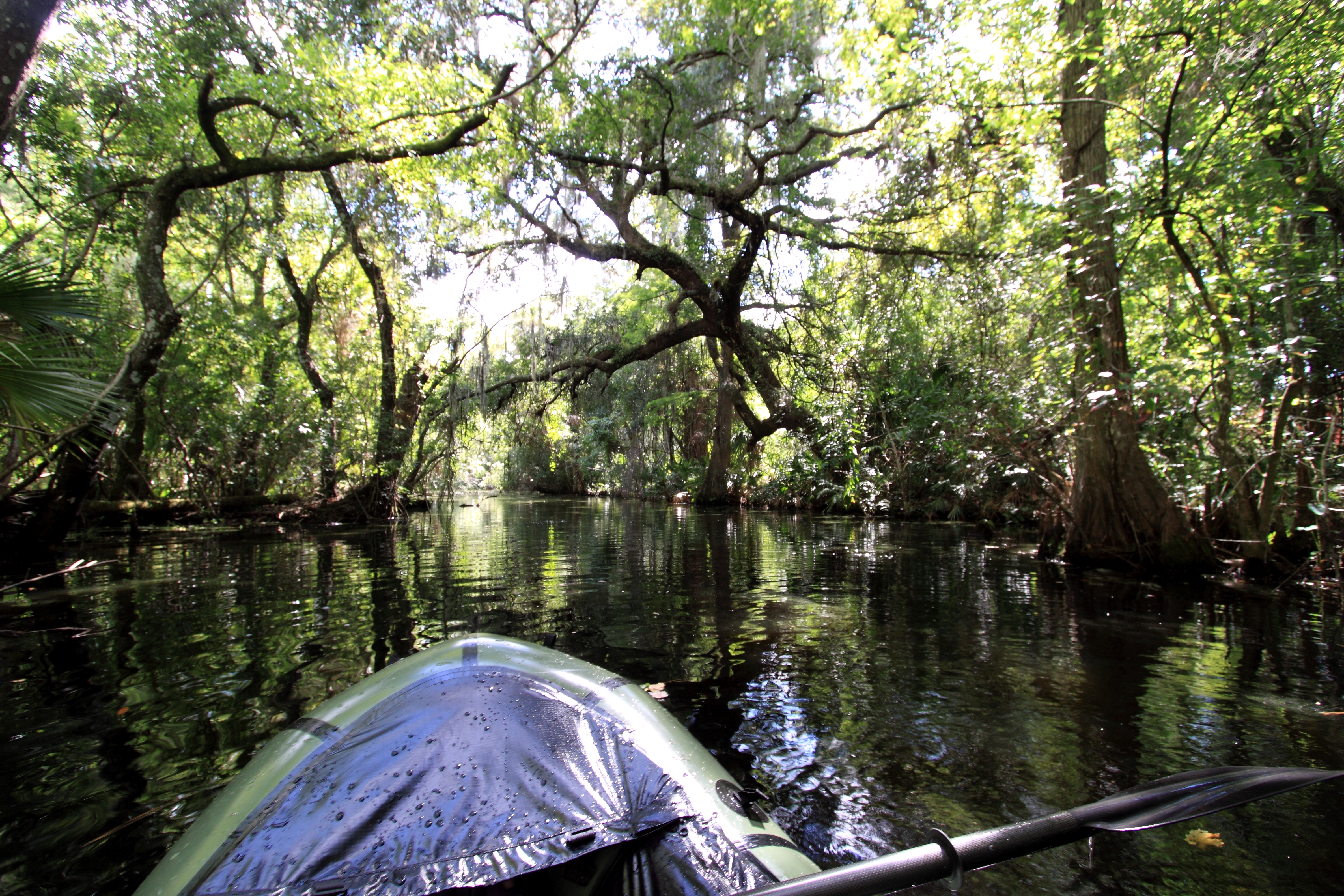
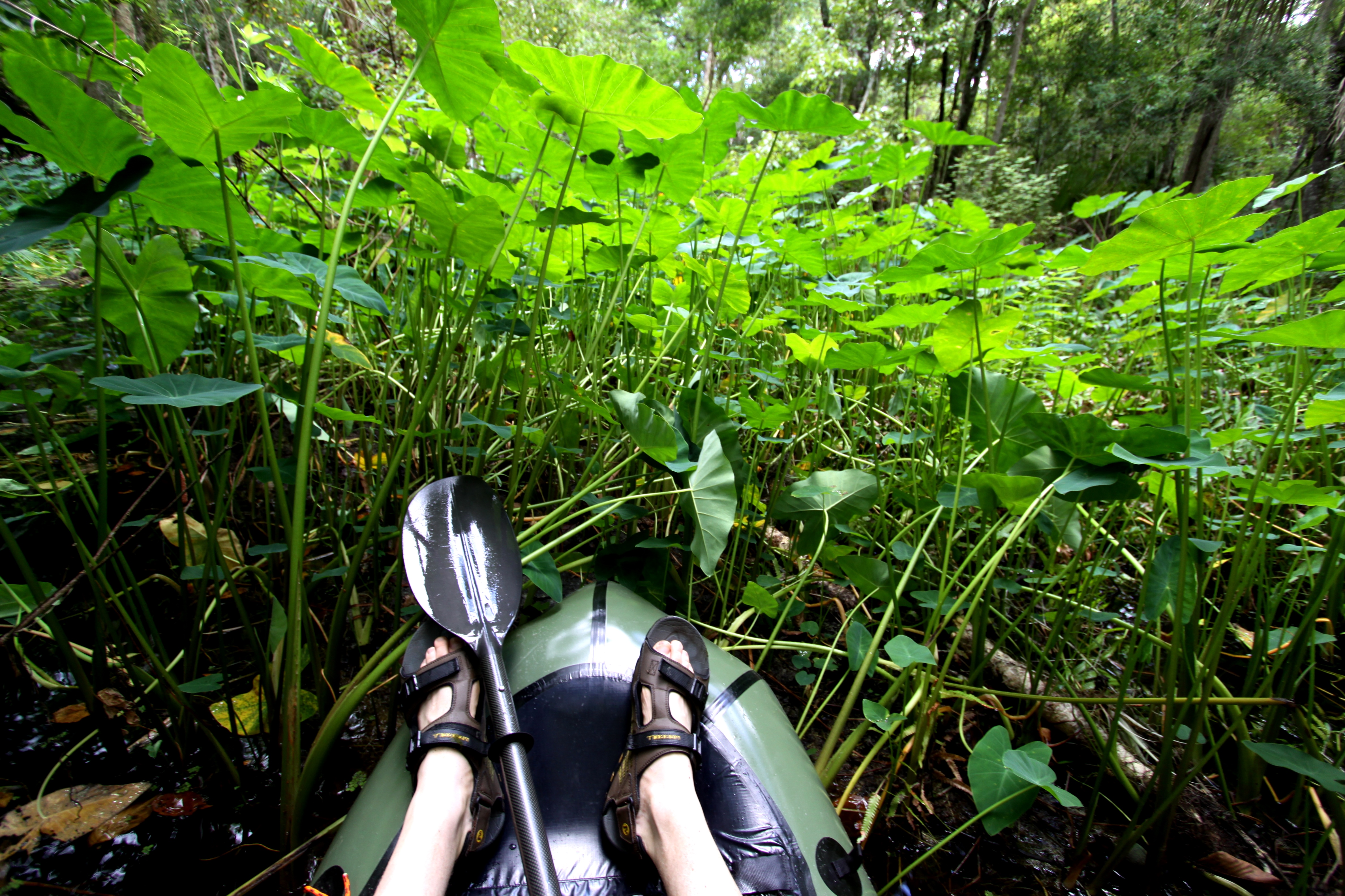
With that he was gone, leaving Paul and me to the adventure at hand: Traversing one of the planet’s last great tracts of unbroken rainforest, a two-week trip on the Kwitaro and Rewa rivers. The black water flowed lazily through a jungle corridor of impenetrable vine and vegetation.

IMG_1108

I’d heard about the Kwitaro from Libor Zicha. Libor had paddled many remote rivers in Guyana, most often solo, and he recommended the Kwitaro as being one of the most pristine. In fact, he’d been attacked by a jaguar on that very river. He was making camp for the night when he heard the crashing of branches and mistook the sounds of a running jaguar with that of a falling tree. Libor ducked and the jaguar leaped over the top of his crouching body. You can imagine his surprise. The big cat continued to approach aggressively but Libor dissuaded the beast by throwing sticks and sand. He was lucky.

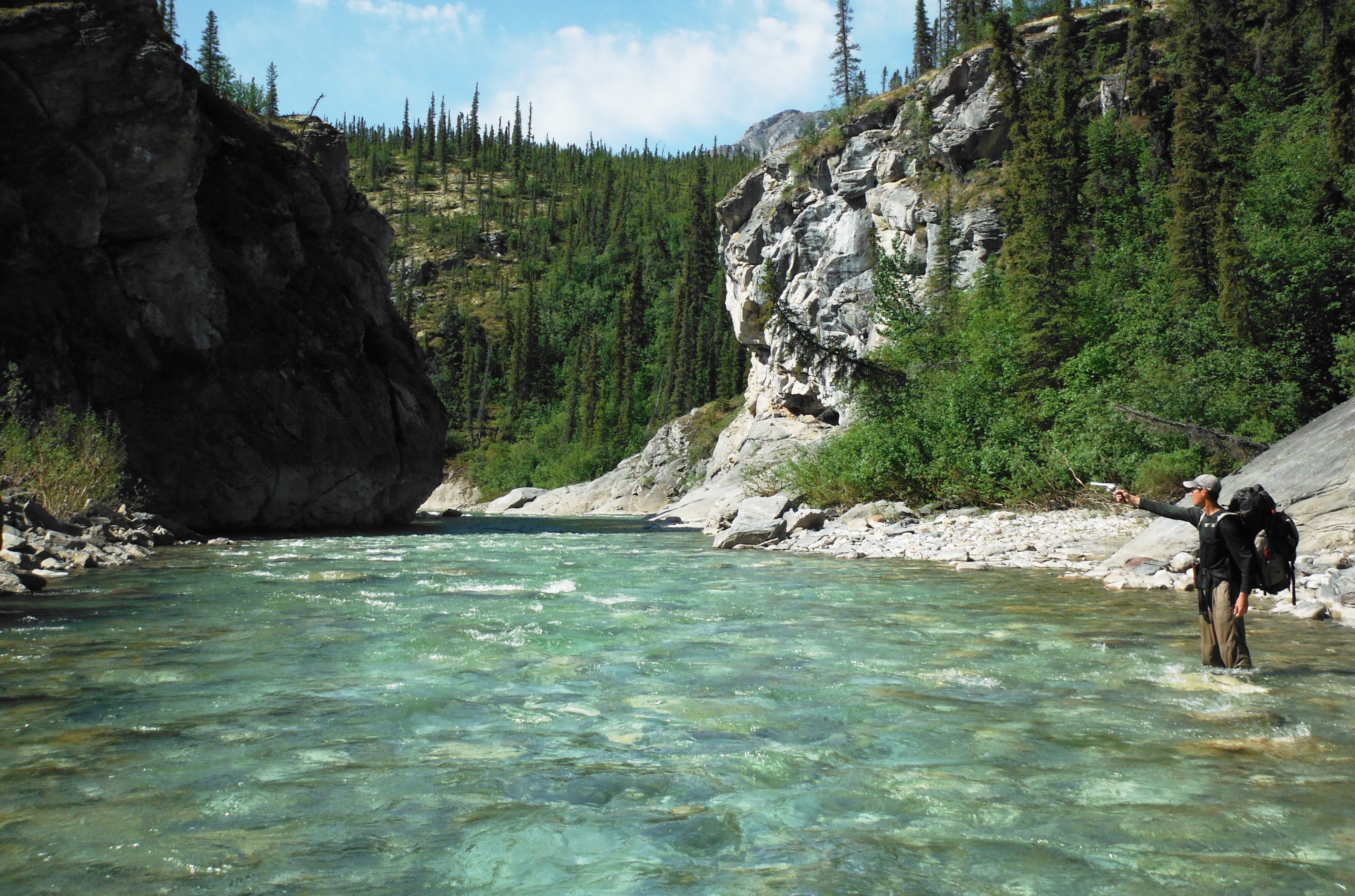
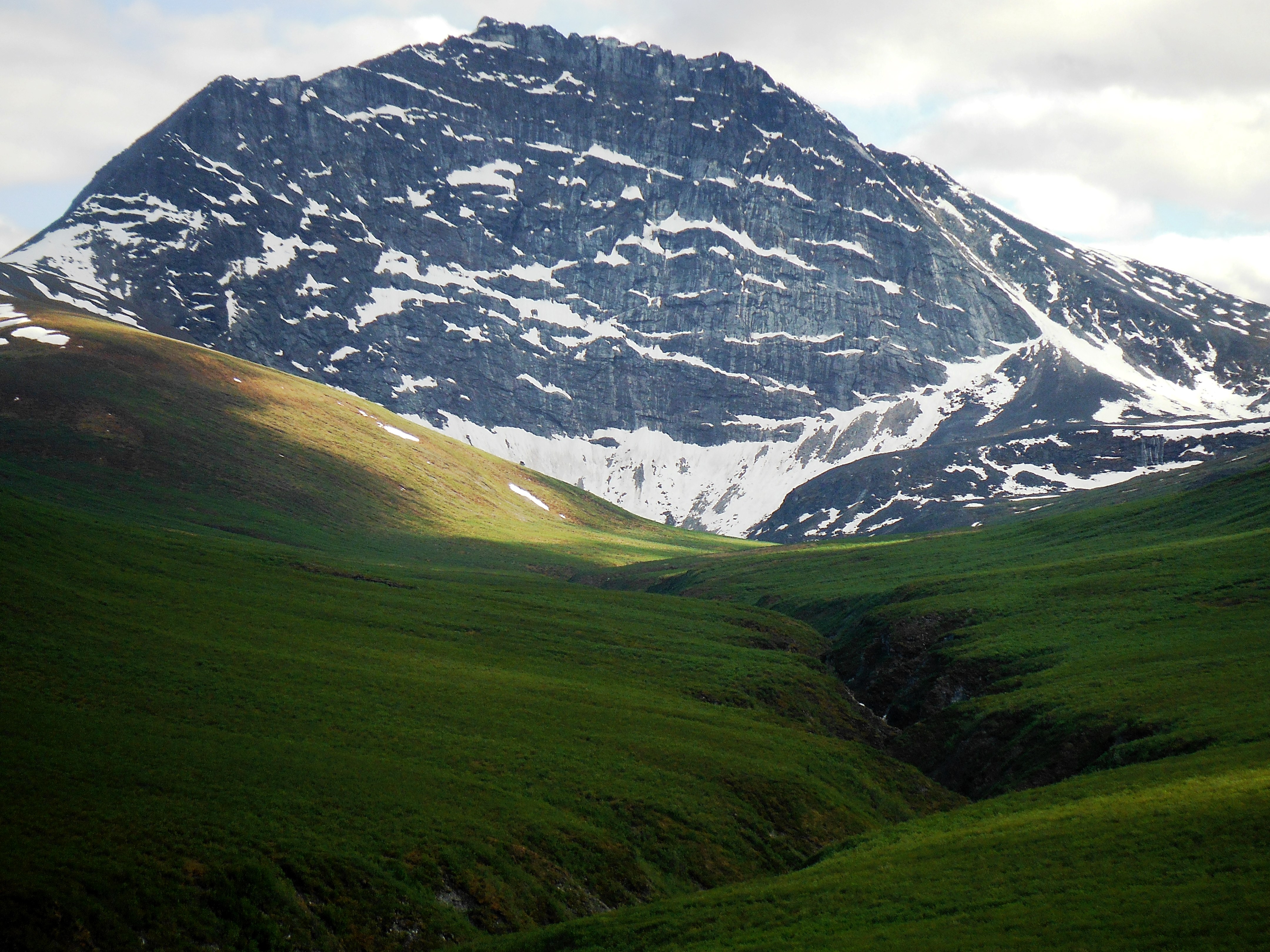
Our plan was to float a portion of the Kwitaro and then portage over to the head of the Rewa River. The Upper Rewa is protected from upriver travel by a series of falls and cataracts. The area is so remote, it’s said the animals there have no fear of man, not necessarily a good thing considering Libor’s story but a place I wanted to see regardless. True Amazonian wilderness!

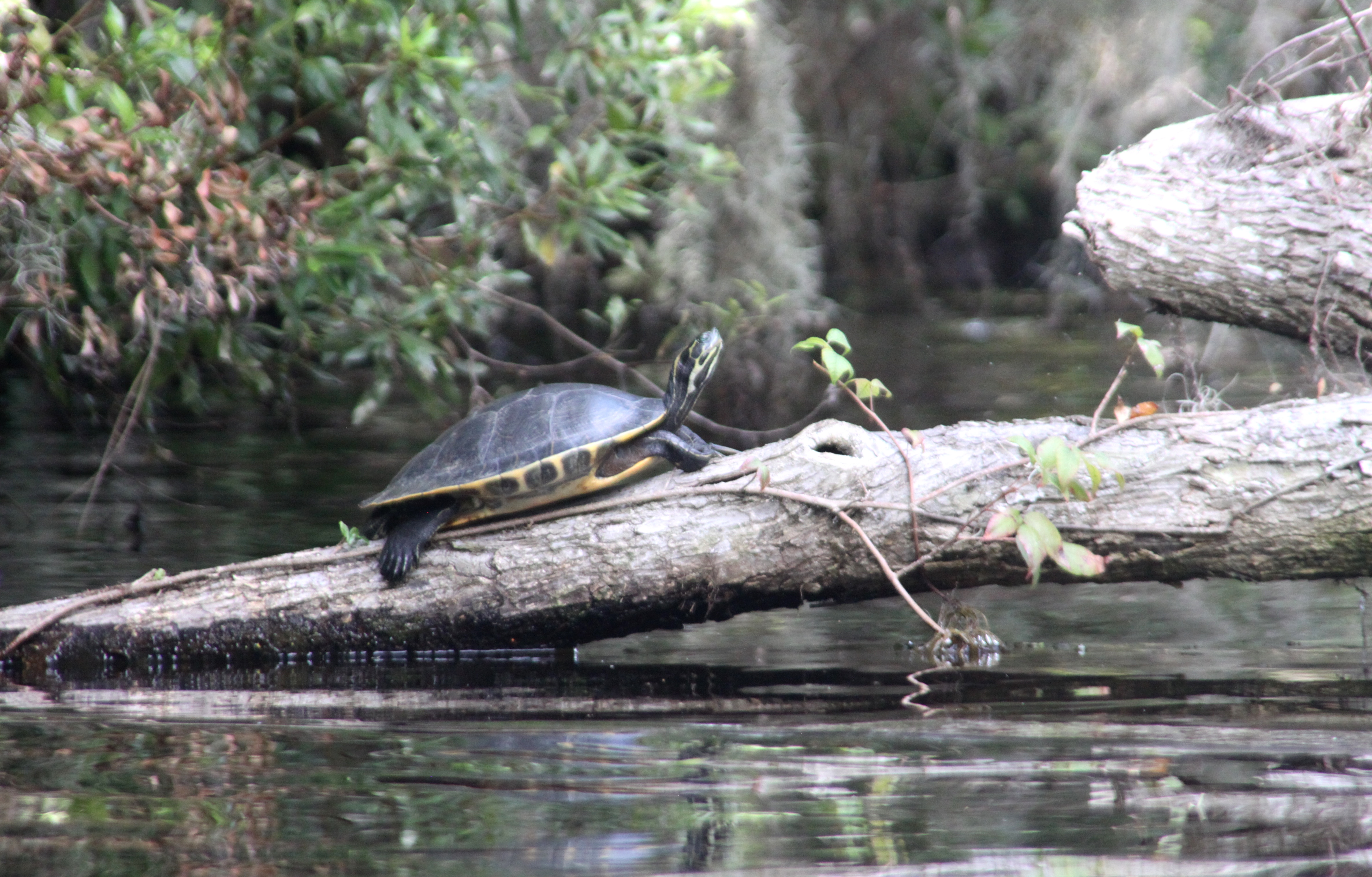
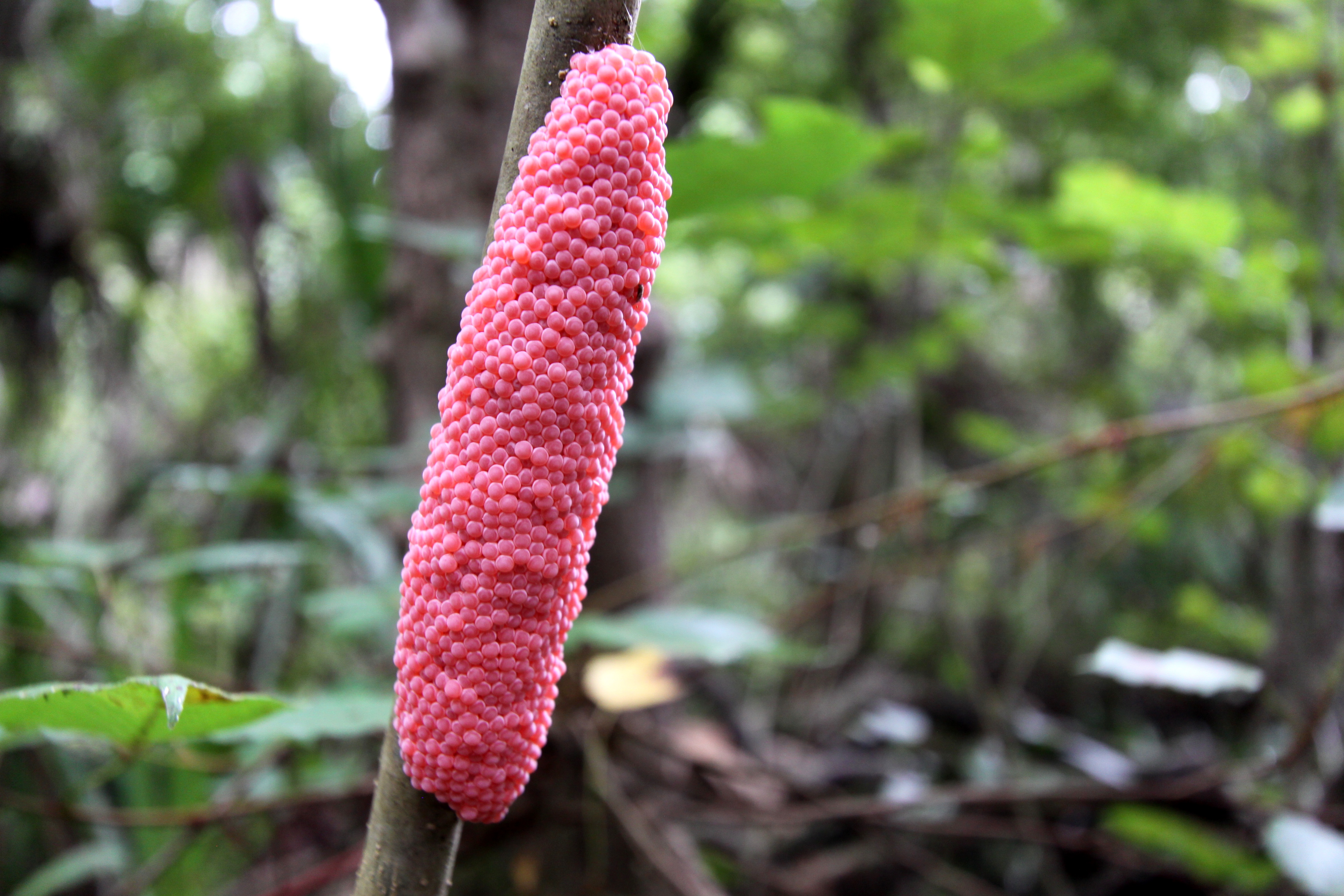
While floating the Kwitaro we spotted a giant river otter devouring a stingray the size of a bicycle tire.

IMG_1107.JPG

IMG_6096.JPG

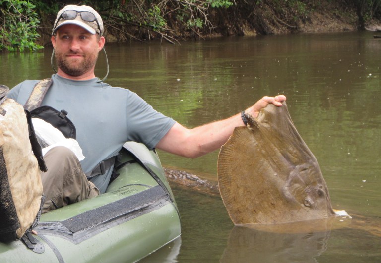
I was thrilled to see such a rare species in its native habitat, but Paul’s attention was riveted on the stingray. He was wary of the rays, especially when dragging the boats over sandbars. Now he treated every shallow section like a hostile minefield.

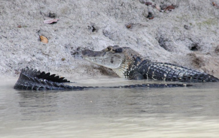
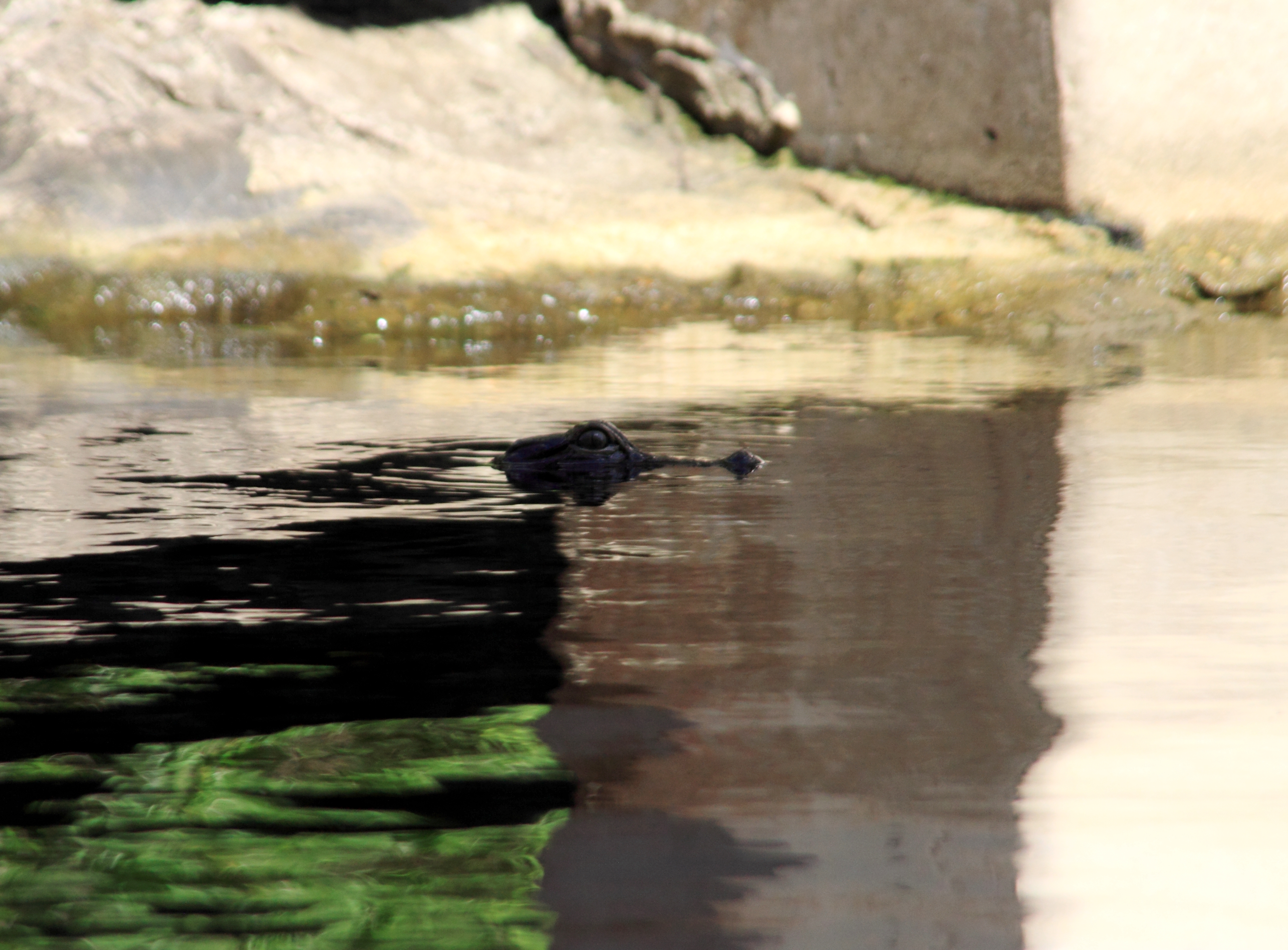
At the end of each day we made sure we were off the water by sunset so our paddling activities didn’t overlap the nocturnal feeding habits of the black caiman, a larger Amazonian cousin of the alligator.

IMG_6134.JPG

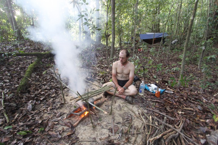
We strung our hammocks, roasting fresh-caught piranha over hot coals as the jungle came alive with an orchestra of bird, frog, and insect calls, all competing to be loudest. The unearthly roar of the howler monkeys eclipsed them all.

IMG_6049.JPG

IMG_5972

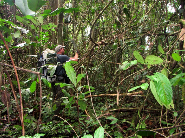
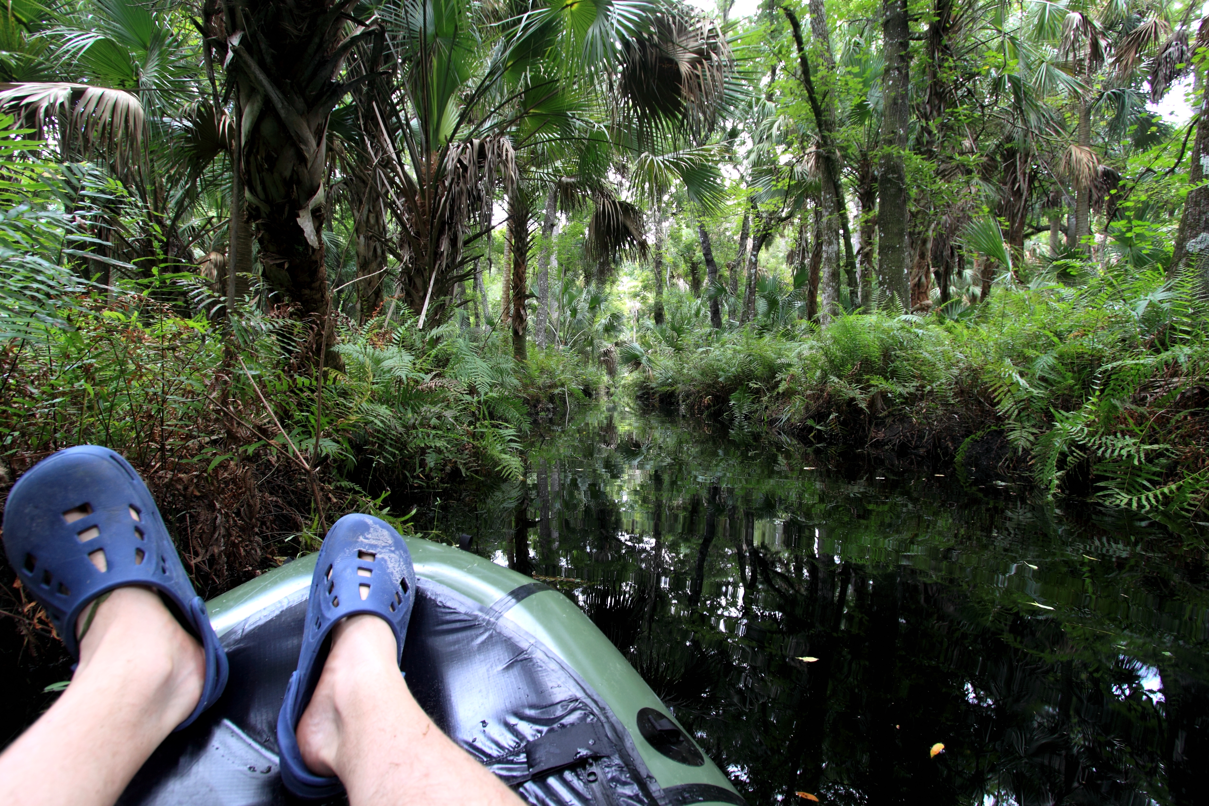
We were traveling during the dry season, so we began the portage to the Rewa by following a small tributary. This was much more difficult than we imagined as the jungle near the creek was extremely thick, the banks a combination of sand and slippery clay.

IMG_1069

Using our brand new machetes we hacked through the undergrowth until we were well away from the creek.

IMG_1072

Once inside the primary forest traveling was easier. Unfortunately, the canopy was so thick my GPS couldn’t get a satellite connection, rendering it useless as a navigational device. Also, we worried about the lack of water. We couldn’t rely on rain during the dry season and the heat and humidity was sweltering.  We used a compass to try and get us back to the creek but once again we ran into thick vegetation. We seemed to be going in circles which our compass confirmed. Getting lost in the jungle was a bit unnerving, as you might imagine, and we used a compass bearing to head straight back to the river.

We decided to continue heading down the Kwitaro, portaging over to the Rewa where the rivers come closer together.

The next couple of nights were a bit daunting. First of all, morale was not exactly high since our little foray into the woods and we were eating very little. One meal, called Tsampa, tasted of rusty nails. Then Paul accidently cut himself with the machete. With the light of my headlamp I could see the wound on his finger was deep. There was blood all over the leaves. We cleaned and superglued the flesh together. A large creature thrashed in the river all night. I tried to pretend like I wasn’t worried, but I was.

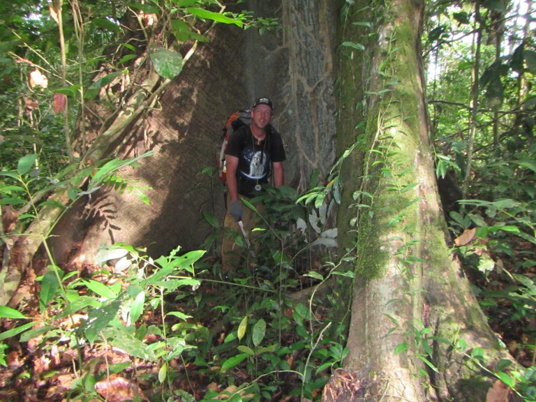
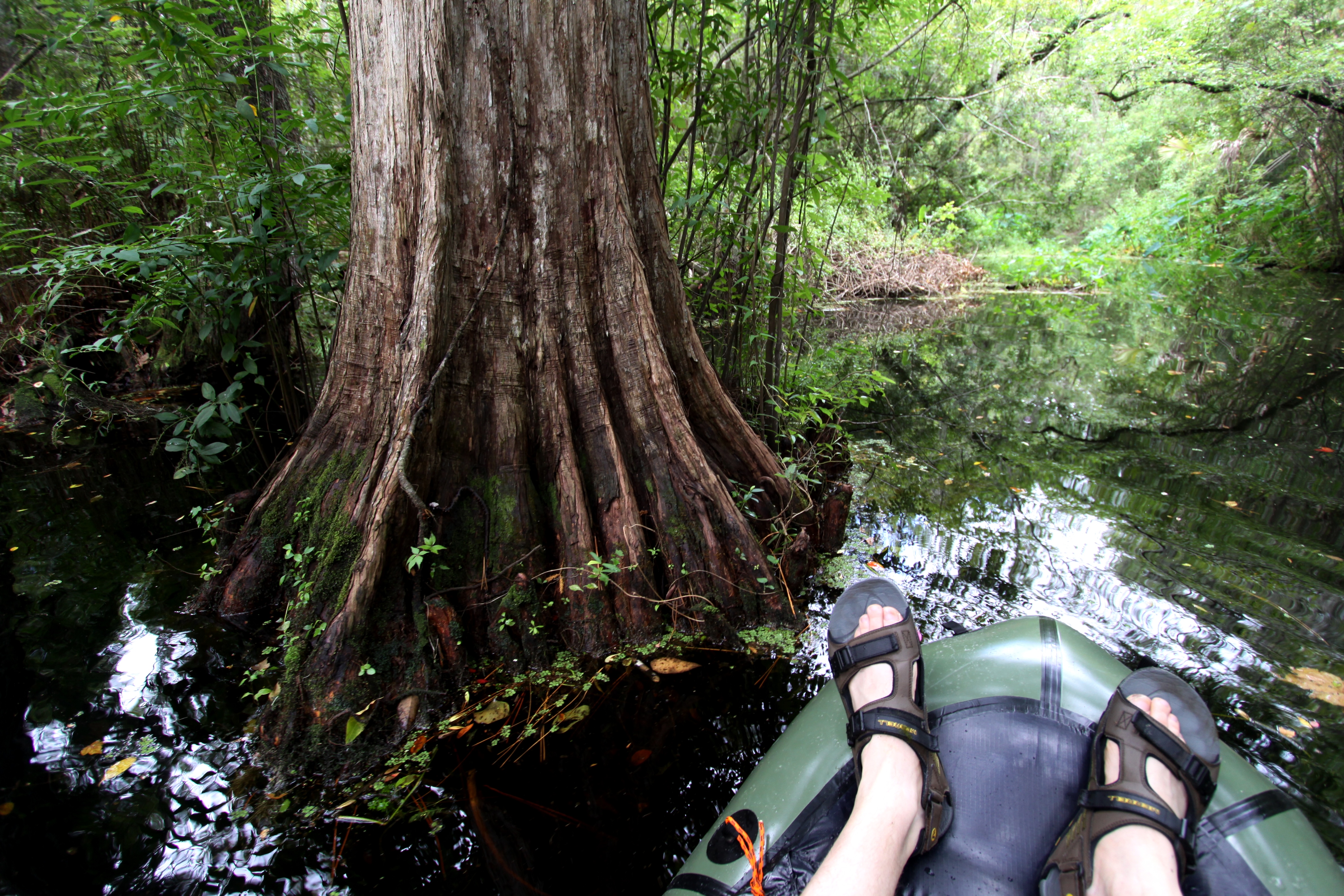
After a few days floating the Kwitaro we portaged the couple miles over to Rewa River. Every 30 seconds we’d check the compass so we didn’t go in circles. There are magnificent trees in the jungle, some the size of redwoods.

IMG_1139.JPG

We could tell we were nearing the river when the jungle grew thick. I found myself hacking at the brush, swinging the machete like a baseball bat as an army of biting spiders crawled up my pant legs.

IMG_1074

When we got to the river we began a grueling upstream paddle. We eddy-hopped for 10 miles until the freshening current bested our efforts and we took to the jungle again.

IMG_1156

IMG_1157

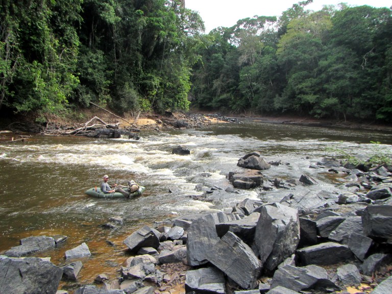
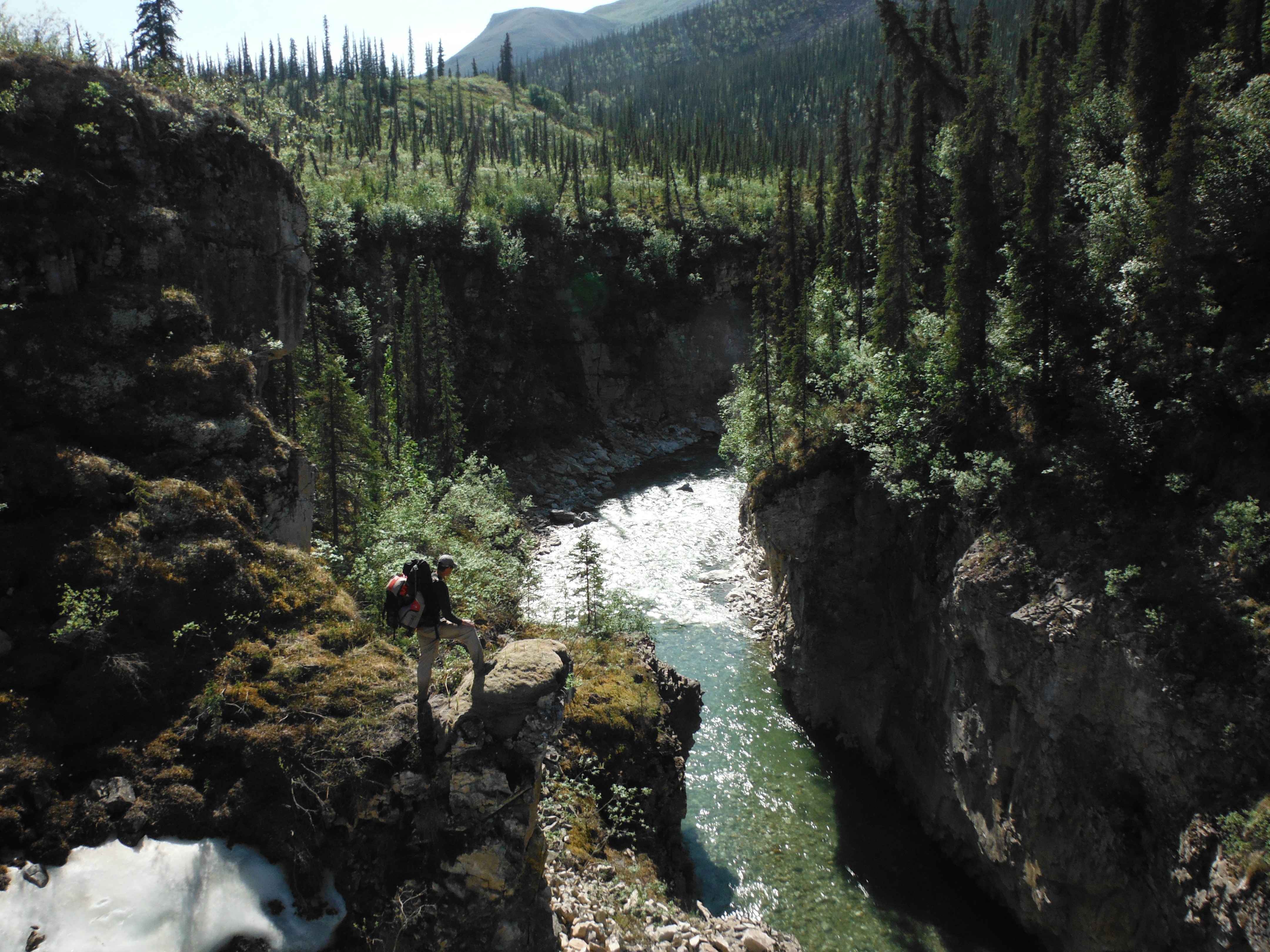
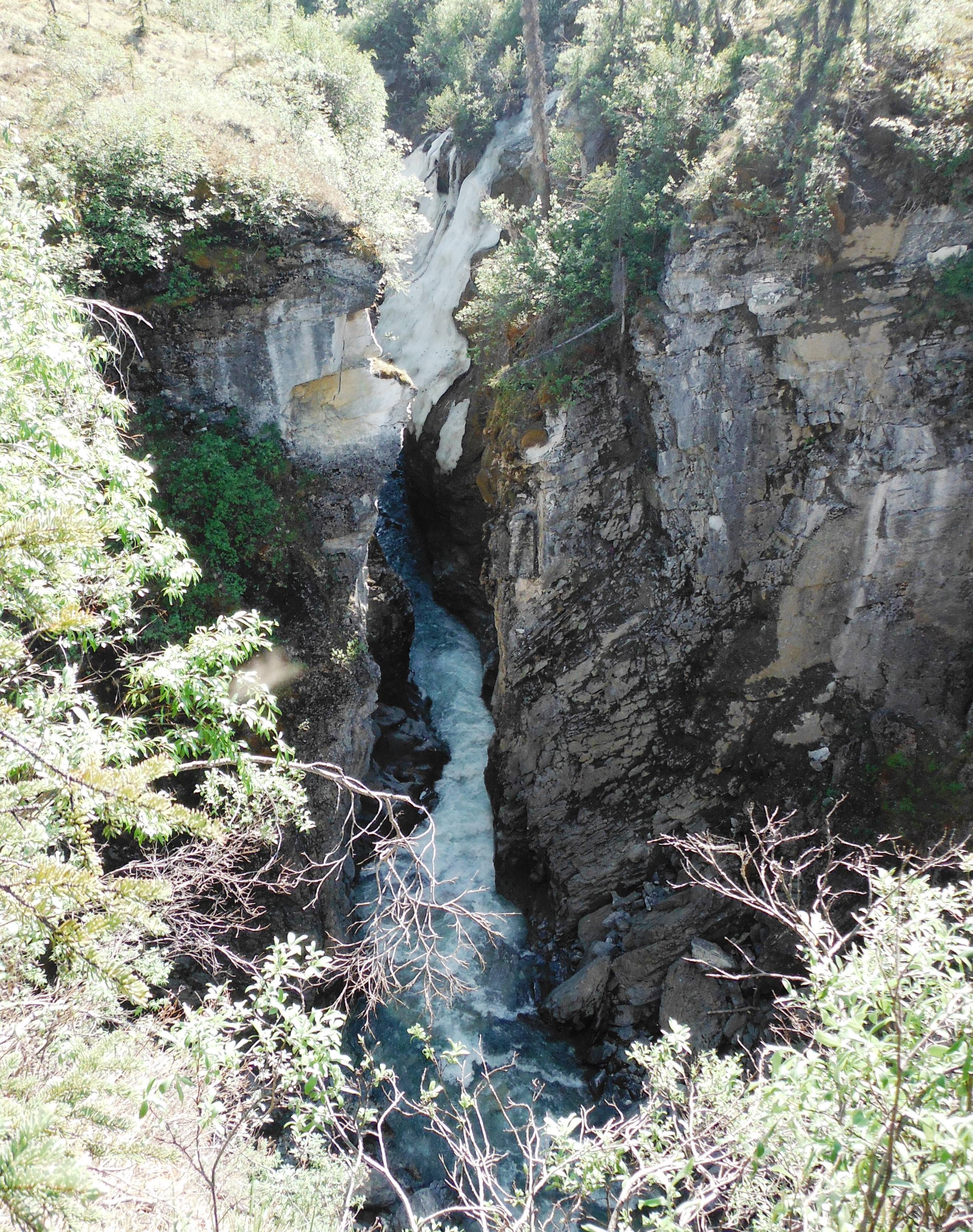
We portaged our lightweight crafts up the rapids to Corona Falls, where the river becomes a torrent of froth and mist as it cascades over a plateau.

IMG_1185.JPG

We saw capybara (a rodent of unusual size) and tapir (something like a pig with an elephant trunk), but no jaguars. The trip’s wildlife highlight was coming across a 20-foot anaconda sunning itself on shore.

IMG_1253.JPG

IMG_1254

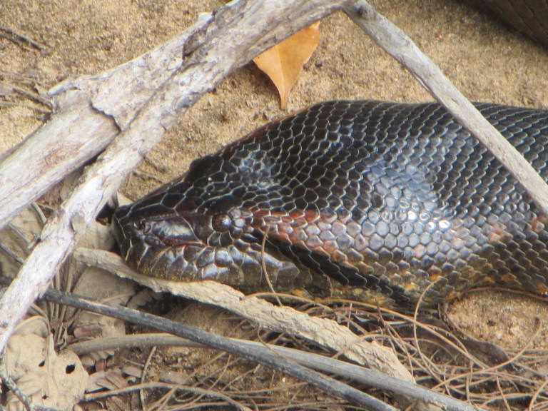
With our palms sweating, we paddled as close as we dared. As a kid I used to love to catch snakes. I’d use my socks as snake bags much to my mother’s horror. Seeing that monster face to face was a thrilling experience. It also made me want a bigger boat.

anaconda2.png

Now back home, I’m still processing everything we saw in Guyana. Those two weeks brought such a barrage of the strange, the primordial, and the unexpected. I can finally take a bath without thinking of piranha, and Paul no longer dreams of stingrays. Or so he says.

In Praise of Brooker Creek, Florida


IMG_5490

The area where Brooker Creek meets Tarpon Lake is a very special place. Wildlife tends to congregate there. And yea gators too but I’ve never been bothered by them. Of course I don’t go at night when they are most active. Funny thing. The day after I took this picture, the local news paper reported that two people were bitten by gators in two separate incidents. That is a very rare thing indeed. I believe you’d have a better chance of being hit by a meteorite. These are American Alligators- not African Crocodiles.

IMG_5520

IMG_5522

DPP_0002

Cypress Swamp. Not a single mosquito bit those beautiful white legs of mine. No mosquitos in the wet season? Never thought about it before.

DPP_0004

Upper Brooker Creek

IMG_5464

These cypress trees can grow to be several feet in diameter and were once logged heavily. I’ve seen cypress stumps in Chassahowitzka the size of redwoods.

DPP_0008

Apple snail

IMG_5466

Apple snail eggs


DPP_0010 DPP_0012 DPP_0014

Oak tree limbs tend to grow horizontally- I loved playing on them when I was a kid.

DPP_0015

Baby Gator. I’ve seen lots of baby gators in Brooker Creek, the bigger ones stay out near the lake. Perhaps its a sanctuary for them.

DPP_0016 IMG_5430 IMG_5447   IMG_5473

All this beauty running underneath McMullen Booth Rd. Smack That!


Iniakuk River- the Arctic’s Best Kept Secret

001

Now when I was a little chap, I had a passion for maps. I would look for hours… and lose myself in all the glories of exploration. At the time there were many blank spaces on the earth, and when I saw one that looked particularly inviting on a map… I would put my finger on it and say, ‘When I grow up I will go there.’

Joseph Conrad, Heart of Darkness

I’ve been a Brooks Range wanderer since 1999 and I can’t seem to stop going back. I’ve floated all the classics- from the Noatak to the Koyukuk and everywhere in between. This year I wanted to find something different. With Google satellite imagery I noticed a topographically unique and intriguing area- the Iniakuk River Valley. Unlike most rivers in the Brooks Range that flow through large U-shaped valleys, the Iniakuk drops into an impossibly narrow canyon. The river derives within Gates of the Arctic N. Park and flows south for 40 miles becoming a tributary of the Malamute Fork of the Alatna River.

To extend the length of our trip, Mike Cragen and I started in Anaktuvuk Pass, floated the John River to Wolverine Creek, and then hiked up that tributary to the headwaters of the Iniakuk. This section has been thoroughly documented on various websites- more info can be seen HERE.

Near the headwaters, we hiked up the southern fork of Wolverine Creek.

002

Brooks Range Traversers typically take the more direct path over Nahtuk Mountain so I was curious if anyone had done this route. That question was answered on the prominent game trail where we found an old grizzly skull imbedded in the tundra- fangs up. Someone would have at least checked it out.

003

We had problems with aufeis (overflow ice) on the John and Wolverine and expected the Iniakuk to be a muddy, scary river as well. We were elated to find a crystal clear stream, shallow enough to walk in when the bushwhacking got bad.

We found enough water to inflate our packrafts at the confluence of the major tributary flowing from the northwest.

About a mile below the outfall of Ernie Lake, the canyon begins.

004

I was informed by Jay Jespersen of Brooks Range Aviation that the Iniakuks first descent was done by veteran guide Chris White back in 1996. Chris and his friend accessed the river via Ernie Lake and used Austrian-made Grabner inflatable canoes. He took paying clients down the river again in ‘97 and ‘98 but it is not known if anyone had been down the river since. Satellite imagery shows the gorge pinching until the river itself disappears.

portage

During the first descent it took Chris and his companion eight hours to get through the first canyon. We decided to portage, which I was bummed about because the entrance was a beautiful PR3. The easy portage is found on river-left and has amazing views into the canyon.

005

Three quarters of the way down, the chasm opens and a difficult PR5 in observed. Apparently the side of the canyon collapsed many years ago and a house-sized rock sits firmly in the middle of the river.

006

To the right, the river goes off a glancing five foot waterfall and to the left, straight into an intimidating cave. I was glad we had portaged. Chris and his clients had to line the canoes through this section; I imagine that was not fun. In some places the canyon was just 12 feet wide with sheer cliffs towering on either side.

007

Below the sieve, the river continues through PR2/3 rock gardens. On river-right a tributary has formed an impressive slot canyon that beckons for exploration.

009

Another mile down a second gorge appears. We didn’t run that one either. We were low on time and the entrance looked gnarly. After the portage we looked back up the canyon. A short river-wide ledge drop poured into a pool of Caribbean-like blue water. Chris White ran this section with his clients (who were experienced whitewater kayakers) in 1998. They considered it a class three.

The river continues as a PR2 with a few spicy surprises to keep you on your toes. The fishing is pretty good too. Every hole conceals hungry grayling. You may even find char and the occasional lake trout.

Bears begin to congregate in the Iniakuk valley mid-July in anticipation of the chum salmon run sometime in August. Chris, who had at least 11 years guiding on rivers in the Brooks considers the Iniakuk to be the ‘beariest’, especially on the lower portion of the river. So be careful, the bears are truly wild there and unpredictable.

We hiked to Iniakuk Lake for our pickup. There aren’t any good camp spots on the lake so spend your last night on gravel bars near the river.

If the Iniakuk were located anywhere else in the world it would be a mecca for whitewater enthusiasts. Mike and I both thought it looked like a river you might find in California but with bears instead of tourists. Who knows, perhaps the Iniakuk will once again fade into obscurity- although, I certainly hope not. It is a truly magnificent place, and it deserves to be recognized.

Here is the video of our trip: