“The whole valley as far as the eye could reach was full of hundreds, no thousands- literally, tens of thousands- of smokes curling up from its fissured floor.”
Robert F. Griggs 1916

Above: Novarupta- site of the largest volcanic eruption of the 20th century.
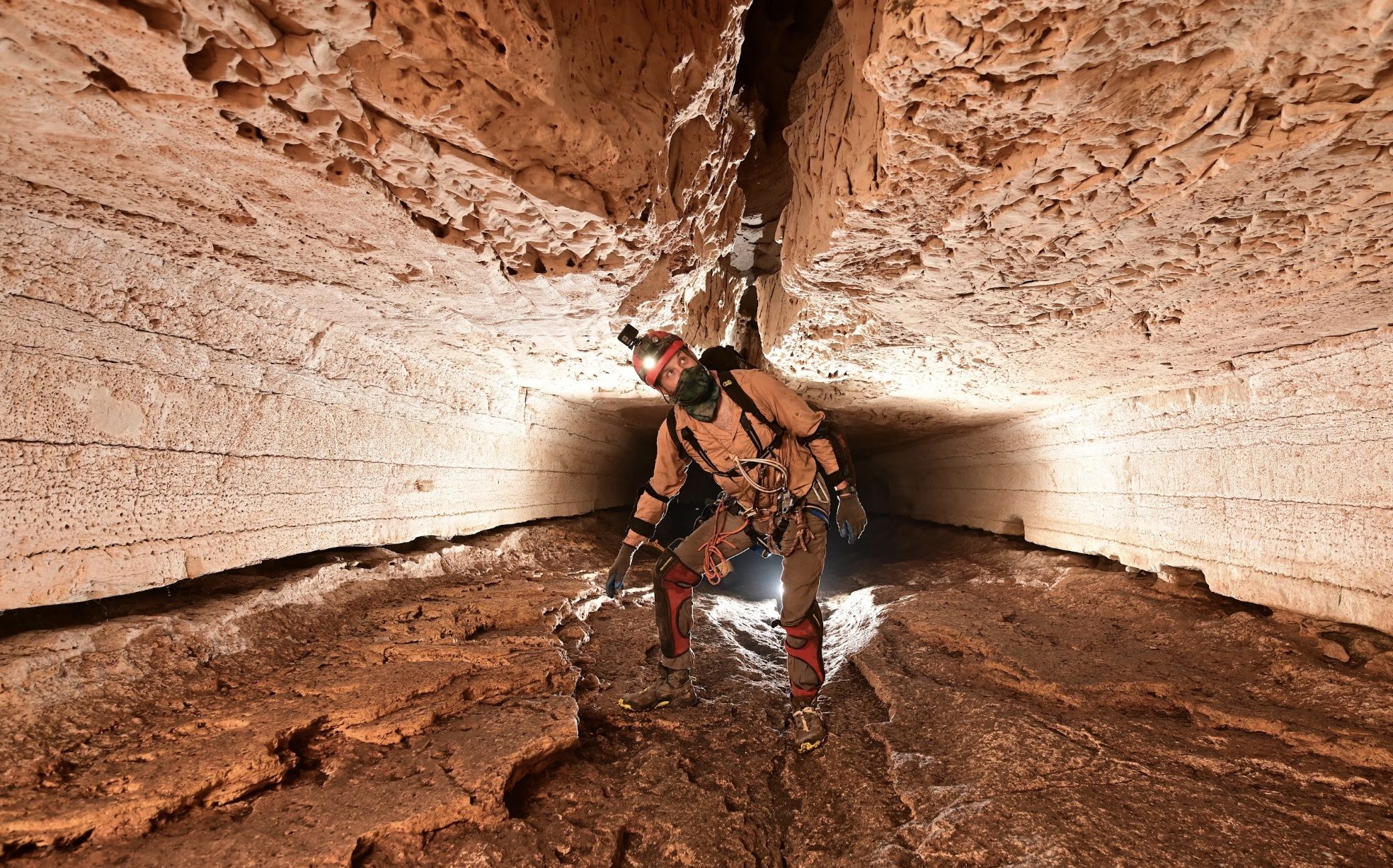
When Novarupta (a previously unknown volcano) erupted on the Alaska Peninsula in 1912, it spewed 2.6 cubic miles of ash across the valley floor resulting in what is now called, the Valley of Ten Thousand Smokes. Today, most of the fumaroles are gone and the valley is no longer filled with smoke but the ash remains. Since the eruption, the rivers have carved chasms deep into the soft ash and the resulting landscape reminds me of sandstone canyons in Arizona and Utah.

I went on a solo, three day hike into the heart of the valley, not really having a plan. The rangers at Brooks Camp told me there was an old USGS hut on Baked Mountain. Since I was sick n’ tired of sleeping in a tent, the hut seemed like a great idea.
I didn’t bring my packraft but I saw some real possibilities there. The Ukak River below Ukak Falls has been done before. It’s a glacial river that has a blind entrance into the canyon and should be scouted first. Looks like sections of PR4. You could then paddle Iliuk Arm back to Brooks Camp.

The trail along the Buttress Range was a good one but once I headed across the vast ash-flow, I felt very small indeed, especially because the clouds were low and I couldn’t see the mountains in the distance.

I headed blindly across the ash, hoping to see the occasional footprint to guide me, but the wind that comes over the pass is like a bat out of hell and erased all the tracks except for one. A fresh dinner-plate sized paw print with claws extending several inches beyond it caught my full attention. I had just witnessed the massive 1500 pound bears of Brooks Camp and the idea that a giant grizzly was out there in the mist, freaked me out. Don’t get me wrong, I feel very privileged to travel in places where wild beasts still roam, that said, I might have started running towards the hut.

Above: Baked Mountain in the distance.
Anyway, the ‘hut’ was ON TOP of Baked Mountain. No one had bothered to mention that part and it wasn’t marked on my topo map. I found it though and ended up spending two nights there.

USGS hut- Mt. Mageik in background.

A windstorm blows ash in the valley. Some hikers bring goggles.


