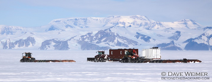
Day 12
Miles Advanced: 76.3
Weather: Overcast, 13F
Today we crossed the Shoals- an area known for crevasses. During our scan we found them to be deep and narrow and would not pose a threat. We carried on without incident.
We are within 35 miles of the mountains now and they loom above. Today I watched my map closely because I wanted to see the Axel Heiberg Glacier. The Axel is the river of ice Amundsen used as his ascent route to the polar plateau and eventually the South Pole where he would become the first person to ever set foot there. Even with a map and GPS I had trouble identifying the Axel Heiberg. You can see the base of the mighty glaciers but where they derive is questionable. Amundsen was an amazing navigator, that’s for certain, but he must have also had great intuition. I can see the glacier just as Amundsen and his men would have seen it a hundred years before and I doubt it’s changed much in that course of time. Without a map, I personally would not have chosen the Axel as a possible means to attain the plateau as it makes a severe turn to the west and appears to dead end at the base of the mountains. Obviously, I’m no explorer. Anyway, I don’t think anyone has ever repeated the ascent of the Axel Heiberg. A decade ago some Norwegians on snowmobiles tried but two of them fell in crevasses and one of them died. The Norwegians were rescued but the dead man’s body was never recovered.